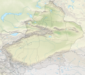
File:China Xinjiang rel location map.svg
外觀

此 SVG 檔案的 PNG 預覽的大小:686 × 599 像素。 其他解析度:275 × 240 像素 | 550 × 480 像素 | 879 × 768 像素 | 1,172 × 1,024 像素 | 2,345 × 2,048 像素 | 2,220 × 1,939 像素。
原始檔案 (SVG 檔案,表面大小:2,220 × 1,939 像素,檔案大小:1.46 MB)
檔案歷史
點選日期/時間以檢視該時間的檔案版本。
| 日期/時間 | 縮圖 | 尺寸 | 使用者 | 備註 | |
|---|---|---|---|---|---|
| 目前 | 2020年2月14日 (五) 20:05 |  | 2,220 × 1,939(1.46 MB) | NordNordWest | == {{int:filedesc}} == {{Information |Description= {{de|1=Positionskarte von Xinjiang, Volksrepublik China}} {{en|1=Location map of Xinjiang, People's Republic of China}} {{Location map series N |stretching=135 |top=49.4 |bottom=34.2 |left=73.2 |right=96.7 }} |Source={{Own using}} * United States National Imagery and Mapping Agency data * World Data Base II data * ETOPO1 data |Date=2020-02-14 |Author={{U|NordNordWest}} |Permission= |other_versions=<gallery>China Xinjiang adm location map.svg<... |
檔案用途
下列頁面有用到此檔案:
全域檔案使用狀況
以下其他 wiki 使用了這個檔案:
- bh.wikipedia.org 的使用狀況
- bn.wikipedia.org 的使用狀況
- cv.wikipedia.org 的使用狀況
- de.wikipedia.org 的使用狀況
- Tocharische Sprachen
- Tian Shan
- Kongur
- Kunlun
- Khan Tengri
- Muztagata
- Lop Nor
- Dsungarische Pforte
- Altun
- Kanasi
- Bosten-See
- Turpan-Senke
- Karakol (See)
- Prschewalski-Gebirge
- Ulugh Muztagh
- Wuluwati-Talsperre
- Tiemen Guan
- Pulu-Vulkan
- Ashi-Vulkan
- Wikipedia:Kartenwerkstatt/Positionskarten/Asien
- Kumtag-Wüste (Dunhuang)
- Shaksgam-Tal
- Aydingkol-See
- Vorlage:Positionskarte China Xinjiang
- Ulungur-See
- Jilintai-Talsperre
- Tarbagataigebirge
- Saurgebirge
- Ebinur-See
- Sayram-See
- Bogda Shan
- Borochoro
- Birliktau
- Changtok Sar I
- Sarpo-Laggo-Gletscher
- Urdokgletscher
- Nördlicher Gasherbrumgletscher
- Skamrigletscher
- Kongur Jiubie
- Kotaklik Shan
- Selik Gulam Muztag
- Bukadabang Feng
- Aksai Chin (See)
- Chakragil
- Koskulak Tagh
- Kokosel Tagh
檢視此檔案的更多全域使用狀況。


