
File:Scg02.png

本预览的尺寸:381 × 599像素。 其他分辨率:152 × 240像素 | 305 × 480像素 | 818 × 1,287像素。
原始文件 (818 × 1,287像素,文件大小:71 KB,MIME类型:image/png)
摘要
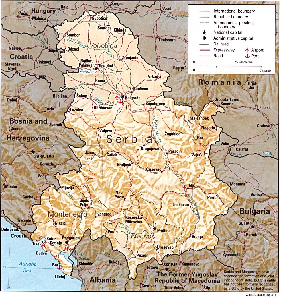
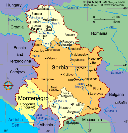
- English: Federal Republic of Yugoslavia (1992-2003) and Serbia and Montenegro (2003-2006).
- Serbian: Savezna Republika Jugoslavija (1992-2003) i Srbija i Crna Gora (2003-2006).
References
- Slobodan Radovanović, Geografski atlas, Magic Map, Smederevska Palanka, 2001.
- Školski geografski atlas, Intersistem Kartografija, Beograd, 2004.
- Miodrag Milošević, Geografija za 8. razred osnovne škole, Beograd, 1994.
- Istorijski atlas, Zavod za kartografiju "Geokarta", Beograd, 1999.
- Denis Šehić - Demir Šehić, Istorijski atlas sveta, Beograd, 2007.
- http://www.lib.utexas.edu/maps/europe/serbia.jpg
- http://www.geographicguide.net/europe/maps-europe/maps/serbia-montenegro.gif
- http://i.infoplease.com/images/myugo.gif
- http://poincare.matf.bg.ac.rs/~geom_workshop/yu1.jpg
Source and licence
Self-made map by PANONIAN
| 本作品已被作者PANONIAN释出到公有领域。这适用于全世界。 在一些国家这可能不合法;如果是这样的话,那么: |

|
This map has been uploaded by Electionworld from en.wikipedia.org to enable the |
文件历史
点击某个日期/时间查看对应时刻的文件。
| 日期/时间 | 缩略图 | 大小 | 用户 | 备注 | |
|---|---|---|---|---|---|
| 当前 | 2015年8月17日 (一) 13:29 | | 818 × 1,287(71 KB) | PANONIAN | Reverted to version as of 19:53, 25 August 2012 |
| 2015年8月13日 (四) 15:07 |  | 818 × 1,287(50 KB) | Shumokuzame33 | spelling mistake corrected | |
| 2015年8月12日 (三) 20:19 |  | 818 × 1,287(50 KB) | Shumokuzame33 | The Name of the Southern Province of Serbia is Kosovo and Metohija | |
| 2012年8月25日 (六) 19:53 |  | 818 × 1,287(71 KB) | PANONIAN | minor correction | |
| 2012年8月25日 (六) 10:21 |  | 818 × 1,287(69 KB) | PANONIAN | minor corrections | |
| 2009年12月14日 (一) 12:44 |  | 818 × 1,287(69 KB) | PANONIAN | improved version | |
| 2006年12月21日 (四) 21:41 |  | 500 × 669(137 KB) | Electionworld | {{ew|en|PANONIAN}} Self-made map by PANONIAN {{PD-user|PANONIAN}} Category:Maps of Serbia Category:Maps of Montenegro |
文件用途
以下页面使用本文件:
全域文件用途
以下其他wiki使用此文件:
- af.wikipedia.org上的用途
- als.wikipedia.org上的用途
- an.wikipedia.org上的用途
- ar.wikipedia.org上的用途
- ast.wikipedia.org上的用途
- azb.wikipedia.org上的用途
- be-tarask.wikipedia.org上的用途
- be.wikipedia.org上的用途
- bg.wikipedia.org上的用途
- bs.wikipedia.org上的用途
- ca.wikipedia.org上的用途
- ckb.wikipedia.org上的用途
- cs.wikipedia.org上的用途
- cy.wikipedia.org上的用途
- da.wikipedia.org上的用途
- el.wikipedia.org上的用途
- en.wikipedia.org上的用途
- es.wikipedia.org上的用途
- eu.wikipedia.org上的用途
- fa.wikipedia.org上的用途
- fi.wikipedia.org上的用途
- fr.wikipedia.org上的用途
- fy.wikipedia.org上的用途
- ga.wikipedia.org上的用途
- gl.wikipedia.org上的用途
查看本文件的更多全域用途。